By Sam Khan | BollywoodView.com
As wildfire risks continue to grow across British Columbia, Canada, a technology company in Kelowna, British Columbia, is turning to artificial intelligence (AI) to help communities prepare for emergency evacuations before disaster strikes.
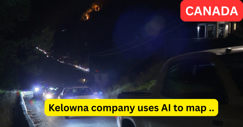
The innovation comes as memories of devastating wildfire seasons remain fresh in western Canada, where thousands of residents have previously been forced to evacuate with little warning. A Kelowna-based company is now using AI-powered technology to map and assess backroad evacuation routes, helping emergency teams identify safer escape paths before wildfires threaten communities.
ALSO READ : Prince George Confirmed for Eton College: Future King to Follow Prince William’s Footsteps
Why Evacuation Planning Matters More Than Ever
Wildfires have increasingly become one of the biggest threats facing many parts of British Columbia, especially regions near forests and rural communities.
In recent years, wildfire emergencies in and around Kelowna and the Okanagan region have forced thousands of residents to leave their homes, often under stressful and dangerous conditions. During the devastating 2023 McDougall Creek wildfire, tens of thousands of people faced evacuation alerts and emergency orders in the region.
The biggest challenge during such disasters is not simply knowing where to go — but understanding which roads are actually safe and usable.
Poor road conditions, washouts, loose rocks, potholes, or narrow backroads can create dangerous situations during mass evacuations.
How the AI Technology Works
The Kelowna company reportedly developed a system called Back Road Intel, designed to evaluate the condition of backroads that may become emergency evacuation routes during wildfire season. The technology was created by entrepreneur Ryan Gallagher after witnessing wildfire challenges in previous seasons.
According to reports, the system uses:
- Sensors attached to vehicles
- Artificial intelligence analysis
- Road condition monitoring
- Hazard detection technology
- Smartphone-connected mapping systems
The system reportedly gathers real-time information about:
- Road damage
- Surface quality
- Dangerous obstacles
- Vehicle suitability
- Route reliability during emergencies
Instead of simply showing a road exists on a map, the technology aims to answer a more important question:
Can families actually use this road safely during an evacuation?
Why AI Could Change Wildfire Response
Emergency planning experts increasingly believe AI-driven disaster preparation may become essential as climate-related emergencies grow more frequent.
The benefits could include:
Faster Decision-Making
Officials may quickly identify safer evacuation paths.
Better Emergency Planning
Communities could prepare routes before wildfire season begins.
Reduced Traffic Chaos
Alternative escape roads may reduce congestion during evacuations.
Improved Safety
Emergency teams may better understand which routes work for different vehicle types.
For families escaping fast-moving wildfires, every minute matters.
Having verified evacuation routes could potentially save lives during critical moments.
Why Kelowna Is Taking Wildfire Risks Seriously
The push for better evacuation mapping comes after difficult wildfire seasons across British Columbia.
The Kelowna region has experienced growing wildfire threats, especially after major fires disrupted communities in recent years.
Experts warn that warmer temperatures, drought conditions, and changing weather patterns are increasing wildfire risks across western Canada. Even the 2025 wildfire season in British Columbia remained highly impactful, despite being less destructive than earlier years.
This has encouraged communities to invest more in:
- Early warning systems
- Smart mapping tools
- AI monitoring
- Better emergency preparedness
Could Other Cities Use Similar Technology?
Many experts believe systems like this could eventually expand beyond Kelowna.
Communities vulnerable to:
- Wildfires
- Floods
- Landslides
- Hurricanes
could potentially benefit from smarter evacuation route analysis.
As climate-related disasters become more common, AI may increasingly play a larger role in helping emergency teams respond faster and make safer decisions.
Frequently Asked Questions (FAQs)
1. What is the Kelowna company doing?
A Kelowna-based company is using AI technology to map evacuation routes ahead of wildfire season.
2. Where is Kelowna located?
Kelowna is located in British Columbia, Canada.
3. What is Back Road Intel?
It is reportedly an AI-powered system designed to assess backroad evacuation routes during emergencies.
4. Why is this important?
The technology may help officials identify safer evacuation routes during wildfires.
5. Why are wildfire concerns growing?
Experts say warmer temperatures and changing climate conditions are increasing wildfire risks.
Final Thoughts
The effort by a Kelowna, British Columbia company to use AI for evacuation planning highlights how technology is increasingly becoming part of disaster preparedness.
Rather than waiting for emergencies to happen, officials are now focusing on prevention and smarter planning.
If successful, this type of AI-powered route mapping could eventually help communities across Canada — and beyond — prepare more effectively for wildfire season and potentially save lives when every second counts.
Author: Sam Khan | BollywoodView.com


- Tiger Shroff, Elvish Yadav and Vicky Jain to Share the Screen? Here’s What We Know
- Jana Nayagan Box Office Collection Day 10: Vijay’s Film Roars Back With Massive Weekend Jump
- Whanganui Fatal Crash: Pedestrian Dies After Being Struck by Vehicle in Gonville
- Indian Judoka Asmita Dey Wins Gold at Commonwealth Games: A Historic Milestone for Indian Martial Arts
- Yeh Prem Mol Liya’ Wraps Shoot: Can Sooraj Barjatya’s Drama Be Ayushmann Khurrana’s Ultimate Comeback?